Springfield, OH–The Ohio Department of Transportation (ODOT) DriveOhio initiative is building infrastructure for the National Advanced Air Mobility (AAM) Center at Springfield Airport in Ohio that utilizes new air traffic control technologies. SkyVision is one of the technologies used in the testing, research, and development of AAM infrastructure at the airport, and two Ohio Federal Research Network (OFRN) funded technologies are supporting SkyVision strategic operations, including Low Altitude Weather Network (LAWN) developed by FlightProfiler and Contingency Management Platform (CMP) developed by CAL Analytics.


SkyVision
LAWN by FlightProfiler
Accurate weather data is essential for adherence to Federal Aviation Administration (FAA) regulatory criteria, which all aviation operations are required to follow. Low Altitude Weather Network (LAWN) delivers meteorological data not provided by other sources so that pilots, controllers, and operators can ensure regulatory compliance and operate more safely.
“Weather affects all aviation operations,” said Ethan Krimins, president, FlightProfiler. “LAWN provides meteorological data needed by pilots, controllers, and operators for vehicle-to-weather awareness and deconfliction.”
In addition to providing statewide weather coverage, FlightProfiler supplies its LAWN technology to the Ohio Department of Transportation FlyOhio initiative. FlyOhio, an initiative of the Ohio UAS Center and stakeholders including JobsOhio, Dayton Development Coalition, the Ohio Federal Research Network, and the City of Springfield, seeks to address this gap by coordinating ongoing UAS research throughout Ohio, while identifying and pursuing future research opportunities, to make Ohio airspace among the first in the nation ready to fly beyond visual line of sight, commonly referred to as BVLOS. FlyOhio also fosters cooperation and collaboration, offers faster access to resources, and improves efficiency for people and organizations that are looking to be a part of the AAM industry.

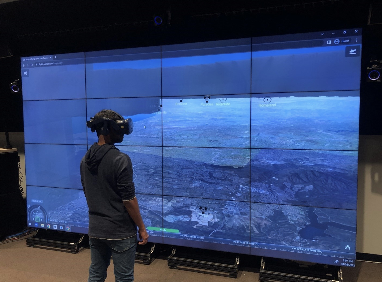
Images of LAWN dashboard
“Micro weather and climate forecasting and modeling in the lower altitude air space is unavailable in new vehicles,” said Rich Fox, Airspace manager, Ohio UAS Center, Drive Ohio. “Currently, small, unmanned aircraft systems (UAS), larger cargo, and people-moving electrified aircraft technologies are not as weather tolerant as our traditional aircraft technologies. Therefore, the need for micro weather forecasting and modeling in the lower altitude airspace is critical for safe operations. LAWN will further aid in our safety mitigations to the FAA, for operation of AAM aircrafts around the Springfield area.”
LAWN’s meteorological data can be displayed in 3D and in conjunction with all airspace operations, which provides several advantages over other weather technologies.
“LAWN technology provides us with a 3D component that we can deploy to normal users and it’s a quick visual reference for users to see if the weather is as it's truly displayed,” said Fox. “This capability significantly raises the bar for the safety of operations concerning AAM and UAS aircraft.”
The FlightProfiler team includes technology expertise in meteorological coding, sensor hardware, and low altitude aviation operations. FlightProfiler has been conducting continuous testing and improvements of the 3D software since 2016 and the LAWN hardware since 2021.
“LAWN will be headquartered at the National AAM Center in Springfield,” said Krimins. “We welcome all operators, pilots, weather information providers and municipalities to join LAWN in making aviation safer and more accessible.”

Image of 3D Weather visualization
OFRN invested $902,498 in LAWN through its Round 5 Sustaining Ohio's Aeronautical Readiness and Innovation in the Next Generation (SOARING) initiative. The project is anticipated to run from October 2021 - April 2023. The OFRN’s funding leverages an initial investment of $51.4 million that was provided by the State of Ohio, Department of Higher Education.
“Above and beyond the funding provided by OFRN, the tremendous technical expertise and collaborative business support allowed our team to launch an innovative aviation technology that has global significance,” said Krimins.
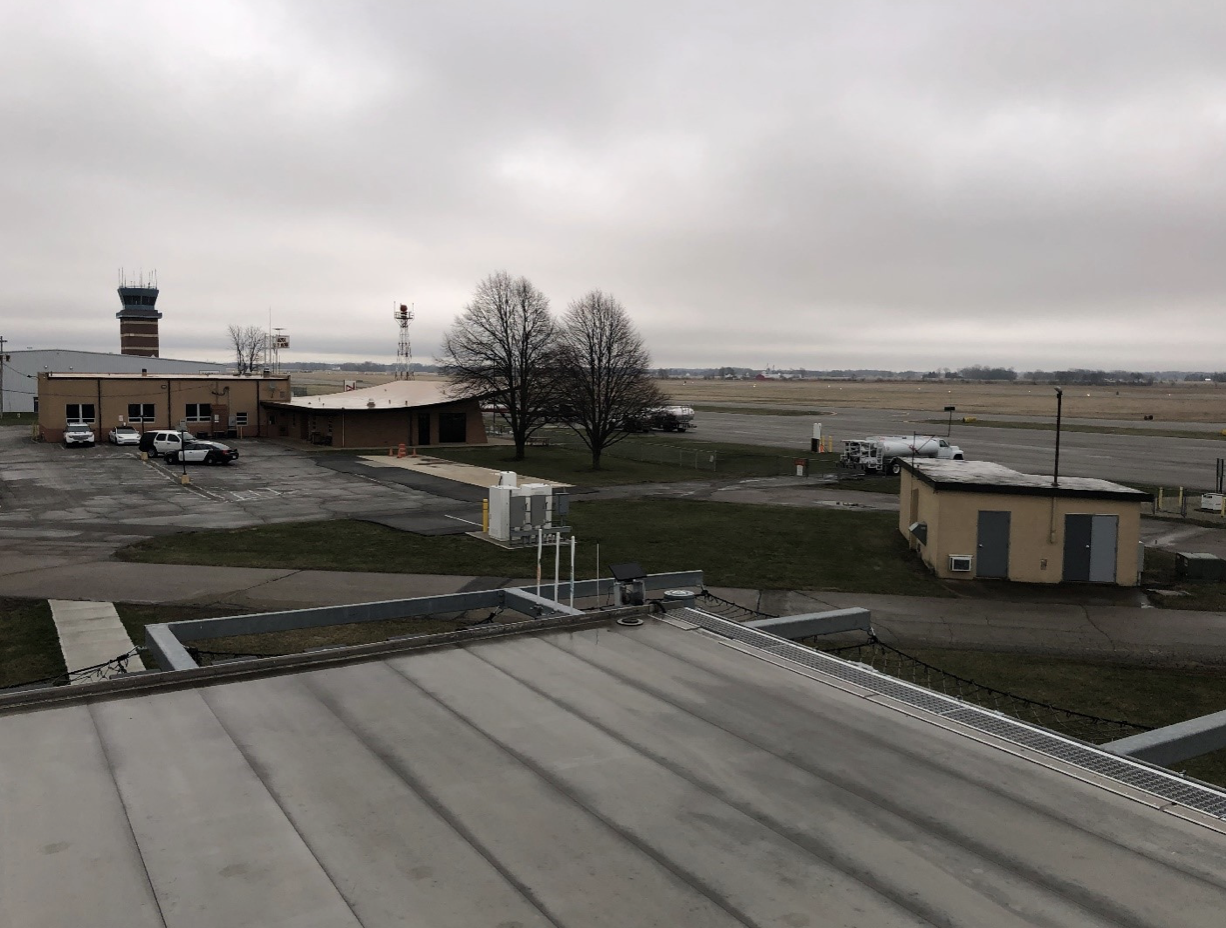
Image of LAWN at Vertiport
CMP by CAL Analytics
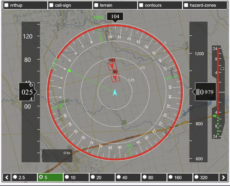
CAL Analytics was subcontracted to Parallax Advanced Research to build a universal translator capability for drone operators to easily connect to the system and utilize SkyVision. SkyVision is a ground-based detect-and-avoid radar system at the Springfield-Beckley Municipal Airport in Springfield, Ohio. The system uses three existing FAA active radar systems to track piloted aircraft allowing for drone flight beyond line of sight and offers airspace monitoring services for aircraft and sensor testing operations. The capability is sponsored by the Ohio UAS Center, the Air Force Research Laboratory (AFRL) in Dayton and other partners. Subsequently, due to their expertise in and contribution to SkyVision advancements, CAL Analytics received an OFRN Round 4 award and an AFRL award to build a Contingency Management Platform (CMP) for managing UAS operations.
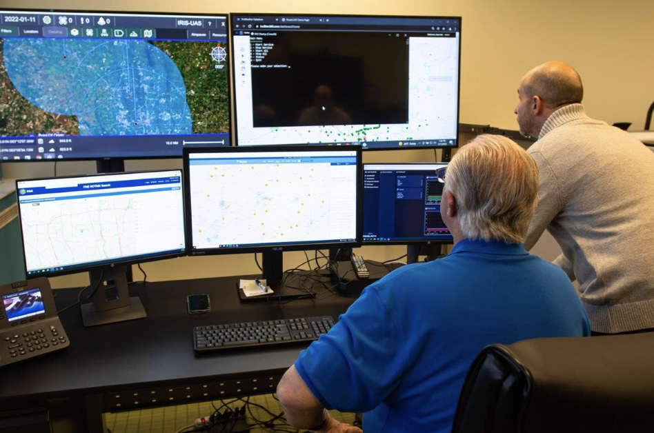
CMP dashboard
“CMP was developed from the premise that, until we solve how to effectively monitor and manage all potential failure conditions, UAS aircrafts and operations for AAM are never going to get approval to operate at the scale that's envisioned,” said Dr. Sean Calhoun, managing director, CAL Analytics. “So, we developed the CMP platform to focus on monitoring the health of the system, making sure all the components run, understanding and assessing the impacts of failure conditions, and relaying information to the parties responsible for managing the systems.”
ODOT uses the CMP technology in its efforts to integrate UAS capabilities in the National Airspace System.
“The CMP brings current radar systems to telemetry feeds that help with operating unmanned aircraft and radars,” said Fox. “And it provides Automatic Dependent Surveillance-Broadcast (ADSB) to assist with the deconfliction, which means making sure that aircraft do not collide into each other.”
CMP is providing many of the services required to manage and operate in the airspace where FAA service gaps exist. Operators and managers of infrastructure, the radar specifically, need to know when there's something wrong, so they can manage that infrastructure to support airborne operations.
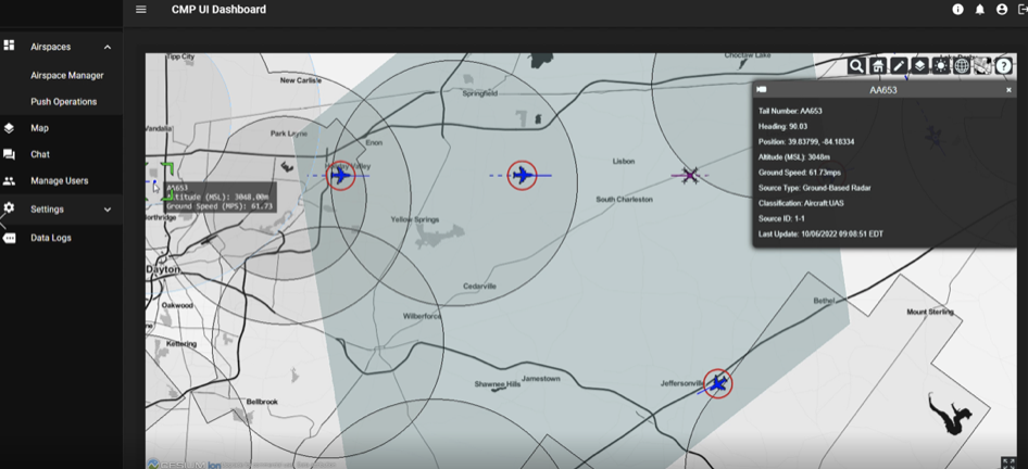
CMP UI Dashboard
“CMP is a tool that ingests all the infrastructure information, providing us a visual dashboard to see if something is not functioning properly. It allows us to relay this information to airspace users. It's all about improving safety,” said Fox.
Since developing CMP, CAL Analytics has received funding to advance the platform into an unmanned aircraft system traffic management (UTM) platform. Its UTM capabilities are applied to larger AAM operations, such as those used for SkyVision, and detect and avoid services for UTM corridor applications, such as small package drone deliveries. CAL Analytics is actively working with the Department of Defense to perform deployment and testing.
“Not only did the OFRN investment help to develop the CMP it also helped develop our UTM capabilities,” said Fox. “There are a lot of great collaborations happening via the Ohio Federal Research Network that are supporting AAM related projects throughout the State of Ohio, and the DriveOhio initiative has certainly benefited from that.”
The OFRN funded $1,399882 in the CMP technology per its Round 4 Sustaining Ohio's Aeronautical Readiness and Innovation in the Next Generation (SOARING) initiative. The project is anticipated to run from December 2019 – March 2022.
CAL Detect and Avoid (DAA) Display
To date, OFRN has funded 35 research projects that involve innovative collaboration amongst 21 universities and community colleges and 97 industry partners throughout Ohio. These R&D projects have attracted more than $355 million in funding from both federal and corporate sponsors for Ohio-based research. The 35 research projects have created 13 Ohio companies and 12 intellectual properties (IPs) with 2 IPs pending. The OFRN has received over $51 million from the Ohio Department of Higher Education since its inception in 2015.
If you are an academic or industry innovator with promising ideas or intellectual property you'd like to commercialize, or if you are interested in collaborating with our network on research projects, or if you need assistance and/or academic or industry partners in pursuit of federal funding opportunities, then we want to hear from you! Contact the OFRN, here.
###
About Parallax Advanced Research
Parallax is a 501(c)(3) nonprofit that tackles global challenges by accelerating innovation and developing technology and solutions through strategic partnerships with government, industry, and academia across Ohio and the Nation. Together with academia, Parallax accelerates innovation that leads to breakthroughs. Together with the government, Parallax tackles critical global challenges and delivers new solutions. Together with the industry, Parallax develops groundbreaking ideas and speeds them to market. Parallax now has offices in Cleveland Ohio, Beavercreek, Ohio and Arlington, Virginia.
About the Ohio Federal Research Network
The Ohio Federal Research Network has the mission to stimulate Ohio’s innovation economy by building statewide university/industry research collaborations that meet the requirements of Ohio’s federal laboratories, resulting in the creation of technologies that drive job growth for the State of Ohio.
About Flightprofiler
Founded in 2006, Flightrofiler is a global leader in meteorological visualizations. Their 3D Weather technology has been refined in collaboration with the FAA to reduce the likelihood of inadvertent VFR (“visual”) flight into IMC (“low visibility situations”). It has grown to become a critical technology for UAS, Advanced Air Mobility, General Aviation, and military operations. Flightprofiler’s mission is to deliver next-generation atmospheric situational awareness to crewed & uncrewed, civil, and military aviation operations.
About CAL Analytics
CAL Analytics is a small business focusing on the development of aviation and autonomous systems. Located in Dayton, OH and founded in 2010, CAL has expertise in navigation systems, remote sensing, signal analysis, and information fusion. CAL is a leader in UAS Traffic Management (UTM) and Advanced Air Mobility (AAM) technology, offering airspace management, mission management, detect and avoid, and in-time system-wide safety assurance (ISSA) solutions. Our mission is to provide agile and rigorous approaches to bring new technologies to the world.