Columbus, Ohio – The Ohio Federal Research Network (OFRN) is funding research and development of the Low Altitude Weather Network (LAWN). LAWN is led by Flightprofiler in collaboration with The Ohio State University, Ohio University, and government stakeholders, including Air Force Research Laboratory (AFRL), Naval Medical Research Unit (NAMRU-D), and NASA Glenn Research Center. LAWN is a ground-based, weather sensor network that provides vertical takeoff and landing (VTOL) vehicles with real-time, low-altitude, high-fidelity, meteorological data.
The LAWN team is delivering low-altitude weather because low-altitude flight conditions are the most needed for pilots of drones, Uncrewed Aircraft Systems (UAS) and Advanced Air Mobility (AAM) vehicles. The technology delivered from this research will be an innovative hardware & software product/service that integrates machine learning with commercial off-the-shelf (COTS) components to measure, collect and communicate low altitude weather data. Ohio University is managing communications for the network, including development of the middleware cloud service. Ohio State University is providing hardware and field expertise, while Flightprofiler is leading program management and system integration.
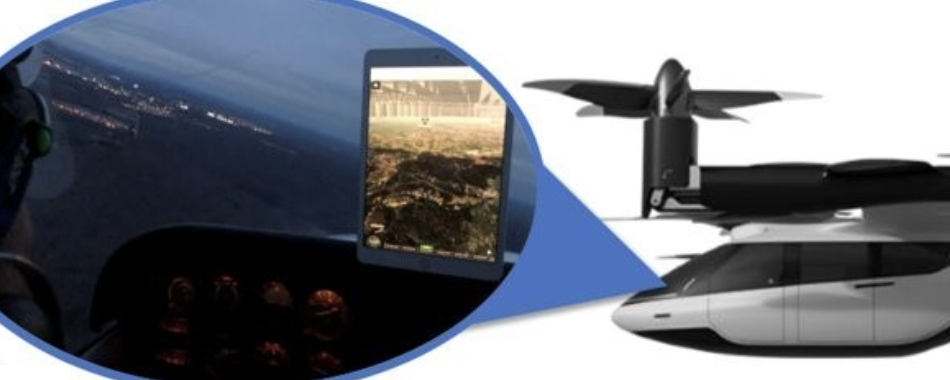
Accurate weather information is critical for Uncrewed Aircraft Systems (UAS) and Advanced Air Mobility (AAM) vehicles to operate safely in the airspace. Other existing weather information is focused on higher altitudes (typically 5000 feet and above). UAS and AAM vehicles operate at lower altitudes of 400 feet (or less), where boundary layer meteorological conditions are different from weather conditions at higher altitude. Therefore, there is a need for a system that can assess and inform about weather conditions at the low altitudes where it is needed.
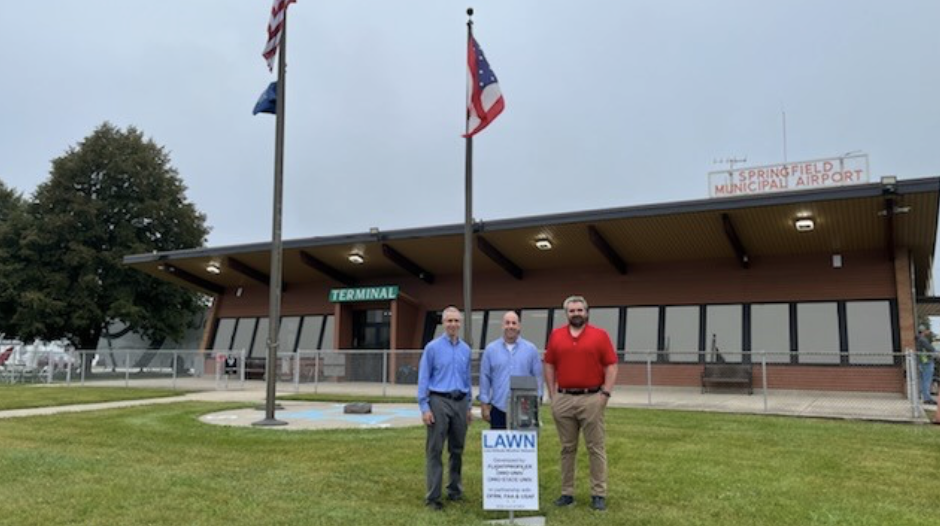
“Our main development effort has gone into the software with which we configure commercial off-the-shelf components,” said Dr. Chad Mourning, assistant professor of Computer Science at Ohio University and principal investigator on the LAWN project. “This software incorporates machine learning techniques to take the camera images and improve weather measurement accuracy. We're configuring them in a form factor that can be placed every square mile or so. As part of the LAWN project, we will be placing twenty-five of our networked sensors around the Springfield Airport.”
The meteorological technology is applicable to other industries, such as transportation and logistics, which needs accurate local weather information. The project team is planning on applying to a University Student Research Challenge (USRC) by NASA to facilitate student projects in this area. USRC provides students, from accredited U.S. colleges or universities, with grants for their projects and with the challenge of raising cost share funds through a crowdfunding campaign.
“As soon as we presented this capability, we were asked about how it may apply to ceilometry,” said Dr. Mourning. “We’re planning on applying the same machine learning techniques used in this LAWN technology to develop a ceilometry estimator and other useful weather sensors.”
Current sensors are expensive, at around $25,000. LAWN sensors can be built and deployed at a fraction of that cost.
“We're hoping to have a world-class sensor technology that can be deployed for about $250,” said Dr. Mourning. “Although, it'll take more of them to create a network, the low-cost plan makes it easy to use multiple sensors and replace them in case of breakdown.”
Flightprofiler’s 3D Weather software is used for flight planning and traffic management, while LAWN provides 3D Weather with improved meteorological data inputs.“This project would not have happened without OFRN,” said Dr. Mourning. “It has been a great experience working with OFRN consultants and leadership, and we’re looking forward to seeing where this opportunity leads our team in the future.”
Along with funding, OFRN’s team matchmaking capabilities helped Dr. Mourning and the Ohio State team connect with Flightprofiler engineers to leverage each other’s capabilities for project development. OFRN experts also provide solicitation navigation support to the LAWN team concerning state and federal follow-on funding opportunities.
###
About Parallax Advanced Research
Parallax is a 501(c)(3) nonprofit that tackles global challenges by accelerating innovation and developing technology and solutions through strategic partnerships with government, industry, and academia across Ohio and the Nation. Together with academia, Parallax accelerates innovation that leads to breakthroughs. Together with the government, Parallax tackles critical global challenges and delivers new solutions. Together with the industry, Parallax develops groundbreaking ideas and speeds them to market. Parallax now has offices in Cleveland Ohio, Beavercreek, Ohio and Arlington, Virginia.
About OFRN
The OFRN has the mission to stimulate Ohio’s innovation economy by building statewide university-industry research collaborations that meet the requirements of Ohio’s federal laboratories, resulting in the creation of technologies that drive job growth for the State of Ohio. The OFRN is a program managed by Parallax Advanced Research in collaboration with the Ohio State University and is funded by the Ohio Department of Higher Education.